
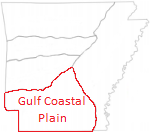
Depositional History of Gulf Coastal Plain in South Arkansas
Sedimentation in the Gulf Coastal Plain in south Arkansas was associated with rifted continental margin tectonics resulting from the breakup of Pangea and the opening of the Gulf of Mexico. Triassic graben-filled red beds were deposited locally as the oldest Mesozoic strata above pre-rift Paelozoic basement during the early stages of extension and rifting.
Paleozoic Era
Undifferentiated Paleozoic (Late Cambrian-Permian)
500-251 Ma
Because of the extreme depth below the surface, little is known of the Paleozoic rocks in south Arkansas, and the history must be inferred from geologic relations in the Ouachita Mountains north of the Gulf Coastal Plain. The Paleozoic rocks in the Ouachita Mountains were deposited during foreland basin subsidence. Most of these sediments were laid down in a deep marine environment and range in age from Cambrian to Carboniferous, attaining an aggregate thickness of at least 35,000 feet. The Paleozoic strata in the Ouachita Mountains were complexly folded into an anticlinorium during the Late Pennsylvanian folding and thrusting epoch of mountain building.
Mesozoic Era
Late Triassic - Early Jurassic (Eagle Mills)
Eagle Mills Formation
210-195 Ma
During Late Paleozoic time thousands of feet of Eagle Mills red beds were deposited in southern Arkansas. The great magnitude of the downwarping south of the mountains is shown by the fact that approximately 7,000 feet of Eagle Mills red beds were encountered in the Humble No. 1 Royston well (Sec. 31, T. 10 S., R. 24 W.) in Hempstead County, Arkansas. Based on the cores from this well and more recent work, the Eagle Mills is considered to be of Late Triassic-Early Jurassic age. Eagle Mills red beds and associated intrusive igneous rocks (diabase and basalt dikes and sills) represent the fillings of grabens or rift basins that actively subsided during deposition in alluvial, fluvial-deltaic, and lacustrine paleoenvironments.
Middle Jurassic (Werner, Louann)
Werner Formation
176-175 Ma
The Werner Formation contains a lower red bed member consisting of red shale and sandstone, commonly conglomeratic at the base, and an upper anhydrite member of relatively pure, dense, granular anhydrite. The Werner Formation unconformably ovelies the Eagle Mills Formation and grades into the overlying Louann Salt; north of the limit of the salt, the Werner is overlain unconformably by the Norphlet Formation. Most authors assign an early to middle Jurassic age for the Werner-Louann interval.
Louann Salt Formation
175-163 Ma
The Louann Salt consists of coarsely crystalline salt which is free of terrigenous siliciclastic material, and anhydrite streaks. Cores taken in deep exploration wells indicate the salt to be white, gray to pale pinkish orange in color. From subsurface control, this salt appears laterally continuous and underlies parts of Texas, Arkansas, Alabama, Mississippi, and probably all of Louisiana. A maximum stratigraphic thickness of 1,300 feet was recorded in the Placid No. 3 Freeman-Smith (Sec. 14, T. 16 S., R. 13 W.), Calhoun County, Arkansas. The thickness is believed to be associated with salt flowage, and may have been the result of basinward thickening of the salt. An original deposition of about 5,000 feet of bedded salt was the result of concentrated marine waters flowing periodically into the basin, more or less isolated from the open sea by barrier bars.
Upper Jurassic Louark (Norphlet, Smackover, Haynesville)
Norphlet Formation
161-159 Ma
The Norphlet unconformably rests on the Louann Salt, the Werner Anhydrite, the Eagle Mills Formation, and undifferentiated Paleozoic rocks, some of which have steep dips. These stratigraphic relations indicate that an uplift and subsequent erosion followed the deposition of the Louann Salt. The Norphlet in southern Arkansas is characterized by gravel with interbedded red and gray mudstone and is largely fluvial. The thickness of the Norphlet ranges from several feet to 150 feet.
Smackover Formation
159-154 Ma
The Smackover Formation was named after the Smackover field, Union County, Arkansas, where it consists of 700 feet of dense to oolitic limestone which lies with apparent conformity above the Eagle Mills red beds and salt and stratigraphically below the Buckner anhydrite. The lower member of the Smackover is characterized by its extremely fine texture and its interbedded anhydrite, which indicates that the salinity of the sea during deposition of most of the lower member could not have been much above normal. The upper member of the Smackover Formation was deposited mainly in shallow, normal marine water, as shown by the presence of oolites, chalky limestone, and shallow-water forms of corals, brachiopods, pelecypods, and gastropods. In the southeastern part of the area (i.e. southern Chicot County) the upper limestone increases in the amount of sand, indicating that there was a land mass or structural high in that vicinity during the deposition of the Smackover. The upper porous oolitic zone, which produces oil and gas in most Smackover lime fields, is called the Reynolds oolite from the discovery well in the Snow Hill area of the Smackover field. One exception is the Midway Field which produces from a deeper zone which is termed the Bond Zone. This latter zone is granular, almost completely non-oolitic and is highly permeable and porous.
In the southwestern corner of the state, the Smackover Formation is probably in excess of 1,200 feet thick; however, near the northern margin of its present extent, it thins markedly due to erosion during post Buckner times. In areas in which the Buckner is missing the Smackover limestone is overlain by the Cotton Valley or younger formations.
Haynesville Formation
154-150 Ma
Haynesville Formation in southern Arkansas rests unconformably on the Smackover Formation. It is composed primarily of fine-grained sandstones, shales, bedded anhydrite, and oolitic limestone that were deposited in a shallow marine environment. The upper portion of the Haynesville Formation in southern Arkansas is characterized by interbedded sandstones and shales. The lower Buckner Member of the Haynesville is composed primarily of red shale, sandstone, anhydrite, and limestone lenses. The Haynesville is locally absent, as in the Schuler field in southern Arkansas, and may vary in thickness up to several hundred feet.
Upper Jurassic (Cotton Valley)
Cotton Valley Group
150-137 Ma
The youngest Jurassic beds belong to the Cotton Valley Group. The Cotton Valley sediments were previously classified as two formations. The lower of these are termed the Bossier facies, and is made up of dark gray to black shale and sand. This facies extends only slightly into southern Arkansas where it is overlapped by the upper part of the Cotton Valley series which is termed the Schuler facies. The Schuler facies is composed of two members differentiated only by lithology and color. The lower member is called the Shongaloo and is composed of near shore red shale, sandstone, and basal conglomerate. The upper member is called the Dorcheat and is made up of near shore pastel and vari-colored shale and sandstone and offshore fossiliferous limestone. The approximate northern limit of the Cotton Valley extends through central Hempstead, Nevada, Ouachita, Calhoun, and Bradley Counties where it is truncated by Lower Cretaceous units. The group thickens basinward to approximately 2,700 ft in southern Lafayette County and to approximately 4,000 feet in the North Lisbon field, Claiborne Parish, Louisiana.
Oil, gas, and gas-condensate are produced from Cotton Valley sands in several southern Arkansas fields. In most places, these sands are very lenticular and often cannot be correlated from well to well in the same field. However, in the Schuler field the Jones sand at the base of the Cotton Valley was found to underlie the entire field and has been the principal producing horizon for the field.
Lower Cretaceous Coahuila (Hosston, Sligo)
132-118 Ma
Hosston Formation
Deposition of predominantly fluvio-deltaic sediments continued during the early Cretaceous in southern Arkansas. The oldest early Cretaceous formation is designated as Hosston Formation (also termed Travis Peak Formation), which overlies the Cotton Valley. Hosston Formation is made up principally of fine-grained sandstones with interbedded clays, shales, and sandy clays. The clays and shale in the upper half are dominantly red, varying in color from pink to dark-red. The lower half contains a greater proportion of sands and generally lighter in shade with light-gray to pale-green and dark-brown colors prevailing. Minor limestones and conglomerates, as well as some lignites and siderites, are also present in the Hosston. Deep wells in Ouachita and Union Counties record more than 1,700 feet of beds without reaching the base of the Hosston. The Hosston Formation contains the early Cretaceous marker spore Cicatricosisporites angicanalis, and the Cretaceous dinoflagellate Oligosphaeridium complex.
Sligo Formation
The Sligo Formation is in the upper Coahuila Series of the Lower Cretaceous period and underlies the Pine Island black shale section of the Trinity group and above the Hosston sands and shales. The Sligo Formation is in conformable contact with the overlying Pine Island, but is time-transgressive on the Hosston Formation as indicated by the dark shallow water marine sediments overlying the nonmarine Hosston sediments. The Sligo in the "Ark-La-Tex" region is composed primarily of gray to brown shales, limy shales and limestones, locally containing lentils of dark gray oolitic argillaceous fossiliferous and sandy limestones and light to dark gray and brown fossiliferous shales. The thickness of the Sligo is less than 100 ft in south Arkansas and greater than 500 ft in central Louisiana.
The type locality of the Sligo Formation is the Sligo field in Bossier Parish, Louisiana. Production from the Sligo is generally referred to as the Pettet Limestone, a term that refers to a productive, porous, pelletal-ooid limestone. The Pettet porosity zones of the Sligo formation have accounted for a major portion of the gas production and a considerable portion of the oil production in the North Louisiana, Arkansas and East Texas areas. Production is obtained from anticlines, fault traps and stratigraphic porosity traps. Of these the stratigraphic trap is by far the most important from the standpoint of accumulated production.
Lower Cretaceous Comanche/Trinity (Pine Island, James, Rodessa, Ferry Lake, Mooringsport)
Pine Island Formation
118-116 Ma
The Pine Island consists predominantly of calcareous black shale with interbedded fine-grained sandstone and minor crystalline limestone layers associated with lagoonal to nearshore marine environments. The widespread nature of the marine shales of the Pine Island is interpreted as regional transgressive deposits. In south Arkansas, the approximate thickness ranges from 50 to 300 feet, with the Hogg sandstone unit as the principal producing zone.
James Formation
116-114 Ma
The James Formation (Late Aptian age) overlies the Pine Island Shale and was deposited in a moderately low energy open shelf environment. Its lithology is quite variable throughout the region. In southwest Arkansas, the James consists of a fossiliferous, dense limestone and red and gray shale. In southern Arkansas, North Louisiana, and East Texas, it is characterized by porous, oolitic, and fossiliferous to fossiliferous-fragmental limestone.
Rodessa Formation
114-112 Ma
The term Rodessa Formation includes the strata above the James Limestone and below the base of the Ferry Lake Anhydrite. The type well for the formation is located in Rodessa Field, Caddo Parish, Louisiana. In this part of Louisiana, the Rodessa Formation consists of oolitic and crystalline limestones, lenticular fine-grained sandy limestone, anhydrite, coquinoid limestones and gray shales. In southern Arkansas, the Rodessa Formation is interpreted as a nearshore, transitional marine sedimentary unit. It contains a number of members, lentils and tongues of which the Kilpatrick limestone, Jeter, Hill (Wesson) sand, Gloyd limestone, Mitchell sand, Dees sand, and Young limestone are productive in various fields of the state.
The Mitchell sand is oil productive, and is positioned between the upper and lower Gloyd members of the Rodessa Formation in the West Bradley field, Lafayette County, Arkansas. These two limestone members are productive in other areas of the Ark-La-Tex region. The Hill sand is an informal subdivision of the Lower Cretaceous Rodessa Formation and forms significant petroleum reservoirs in many parts of northeast Texas, southern Arkansas, and northern Louisiana. The North Shongaloo-Red Rock Field is located in north-central Webster Parish, Louisiana and southern Columbia County, Arkansas. The Hill sand is lithologically variable within this region and consists of conglomerate, fine-grained sandstone, siltstone, mottled red to green claystone, black shale, and occasionally fossiliferous limestone. Thickness of the Hill sand typically ranges from 160 to 220 feet and averages 186 feet.
Ferry Lake Anhydrite
112-109 Ma
The Lower Cretaceous Ferry Lake Anhydrite is one of the most distinctive, widespread sedimentary units within the Gulf Coastal Plain. The formation extends from east Texas across southern Arkansas, northern Louisiana, central Mississippi, and southern Alabama, and to south Florida where it has been correlated with anhydrite beds of the Punta Gorda Formation. The approximately 250 feet thick Ferry Lake Anhydrite was deposited above the Rodessa in an extensive lagoonal sea. It is believed that the thickness of individual beds accumulating within a lagoon was controlled mainly by water depth, development of a restrictive barrier, subsidence, duration of each evaporative pulse, and areal salinity variation. The Ferry Lake is described as consisting of white to gray, finely crystalline anhydrite that contains minor amounts of interbedded gray to black shale, dense limestone, and dolomite.
Only minor production has been reported to date from fractured intervals within the Ferry Lake Anhydrite associated with scattered fields within the Gulf Coastal Plain. Hydrocarbon production in Caddo-Pine Island field, Louisiana was found from the thin Haygood Limestone near the base of the Ferry Lake Anhydrite.
Mooringsport Formation
109-107 Ma
The Mooringsport Formation (Early Albian age) consists of shallow marine carbonates that are predominantly crystalline and fossiliferous limestone interbedded with sandstone, red beds, anhydrite, and shale. The relatively rapid subsidence and sea level rise is responsible for the vertical growth of the Mooringsport reef complex of up to 1,600 feet thick.
Lower Cretaceous Comanche-Fredericksburg/Washita (Paluxy, Goodland, Kiamichi)
Washita and Fredericksburg Groups
107-99 Ma
The Washita and Fredericksburg groups are represented at the outcrop in southwestern Arkansas by Kiamichi clay, Goodland limestone, and Paluxy sand.
The Middle-Upper Albian Paluxy and Goodland Formations are considered part of the Fredericksburg Group. The Paluxy Formation consists of nearly non-fossiliferous variegated shales and sands which grade laterally and downward into the Mooringsport Formation. The distribution of the Paluxy Formation is limited on the north by the outcrop in Sevier, Howard, and Pike Counties and its truncated eastern edge by a line drawn from the outcrop on Range 20 West at the Arkansas-Louisiana boundary. The Paluxy ranges in thickness from about 200 feet at the outcrop to 1,200 feet in the subsurface of the southwestern corner of the state. The lenticular sands of the Paluxy Formation are productive in the southwestern part of the state with the “Sturgis” series being very prolific locally.
The Goodland Limestone is abruptly separated from the underlying Paluxy Formation. At the outcrop, it consists of medium- to thick-bedded, hard, sandy, light gray limestone with minor thin-bedded calcareous sandstone. Whereas the thickness is less than 50 feet at the outcrop, it increases to more than 100 feet in the subsurface.
The Upper Albian Washita Group was truncated by the post-Comanchean uplift and erosion. With the retreat of the seas, up to 10,000 feet of sediments were removed by erosion in southwest Arkansas. The Kiamichi Formation is the only beds of the Washita Group that are present in the state. It is composed of closely packed oyster shells in a matrix of dense, hard, gray-green marl interbedded with softer gray and green marls. Almost all fossils associated with this unit are assigned to Gryphaea navia. A maximum stratigraphic thickness of 20 feet is reported for the Kiamichi.
Upper Cretaceous Gulf Series (Tuscaloosa, Austin, Taylor, Navarro)
Tuscaloosa Group
98-87 Ma
The Tuscaloosa Group of southwest Arkansas is unconformably underlain by the Kiamichi clay, and is composed of bedded gravel, sand, bedded clay, and water-lain volcanic tuff and ash. The basal part of this unit is marked by gravel of variable thickness. The overlying water-lain volcanic tuffs are sandy and cross-bedded. The Tuscaloosa sandstone is between 250 and 350 feet thick in southwestern Arkansas.
Most sandstones contain less than 10% quartz, but have abundant oligoclase, Ti-rich pyroxenes, and magnetite. Sandstones contain abundant smectitic clay formed by diagenesis of the volcanic material. The igneous rocks represent eruptive and hypabyssal equivalents of intrusive alkalic rocks of Cretaceous age in central Arkansas.
Austin Group (Tokio, Brownstown)
87-82 Ma
In South Arkansas, the Austin Group includes Tokio and Brownstown Formations. The Tokio Formation is separated from the underlying Tuscaloosa sandstone by a distinct bed of conglomerate composed chiefly of novaculite. The Tokio Formation consists principally of intertonguing dark-gray lignitic clays and cross-bedded sands west of Little River and of sands and novaculite gravel east of Little River. This formation thus exhibits a marked lateral change in lithology in the short distance represented in the outcrop, and correspondingly marked lateral changes are found in their subsurface extension. The thickness of Tokio is about 300 feet in the southwest corner of Arkansas, but it thins to the east.
The Brownstown rests unconformably on the underlying Tokio Formation. In Miller and Lafayette Counties and parts of Columbia and Nevada Counties, the Brownstown marl consists of dark-gray calcareous clays, marls, and shales, generally in massive beds and free of sand, with some thin beds of impure limestone. Farther to the east in Ouachita and Union Counties, the formation becomes increasingly sandy and is composed chiefly of fine-grained, in part glauconitic quartz sand, with gray, fine, sandy marls and clays. In its easternmost extension, the Brownstown marl is composed chiefly of fine-grained and argillaceous sands. The Brownstown marl is slightly more than 200 feet thick in Miller County, but thins east of western Union and western Ouachita Counties. The Blossom sand is the principal producing zone of the Brownstown Formation.
Taylor Group (Ozan, Annona, Marlbrook, Saratoga)
82-71 Ma
The Taylor Group averages 300 feet thick in south Arkansas and from the youngest to oldest includes the Saratoga Chalk, Marlbrook Marl, Annona Chalk, and the more siliciclastic Ozan Formation. These are primarily shallow marine deposits consisting of hard, gray glauconitic fossiliferous chalk, calcareous shale, marl, fine-grained sandstone and siltstone in south Arkansas.
The Ozan Formation consists of sandy, micaceous marl, and in its lower part, of glauconitic marl and sand. This basal sand crops out a short distance north of the village of Buckrange in Howard County. The Ozan Formation produces from the Meakin, Baker, Graves and Buckrange sands primarily in the Ouachita and Union Counties areas.
Navarro Group (Nacatoch, Arkadelphia)
71-68 Ma
The uppermost sequence of the Gulfian Series is the Navarro Group consisting of the Nacatoch and Arkadelphia formations. The Nacatoch Sand, which unconformably overlies the Saratoga chalk, is a shallow marine deposit consisting predominantly of fine- to medium-grained unconsolidated quartz sandstone, sandy limestone, clay, marl, and shale. Sandstones tend to be glauconitic, ashy and argillaceous. The Arkadelphia Marl also consists of shallow marine sediments, mainly light gray chalk or marl with calcareous, micaceous sandstone, and minor volcanic ash. The Navarro attains a maximum thickness of 550 feet in southwestern Arkansas, but thins gradually eastward.
The Monroe Gas Rock Formation, originally described in the Monroe Gas field, is a shallow marine deposit consisting of hard white and gray sandy chalk that extensively produces in the Monroe Gas field in northeastern Louisiana, but continues into southern Union County, southern and eastern Ashley County, and northern Chicot County, Arkansas. In these areas, it rests on strata ranging in age from Marlbrook to Lower Trinity and is overlain by strata of Midway Formation. The Nacatoch Formation cannot be differentiated from the Monroe Gas Rock. The areal distribution of the Monroe gas rock coincides closely with the extent of the Monroe Uplift.
Cenozoic Era
Tertiary Paleocene-Eocene (Midway, Wilcox)
Midway Group
61.5-59.1 Ma
The end of the Cretaceous is characterized by an interruption of deposition, accompanied by withdrawal of the seas, resulting in a widespread regional unconformity at the base of the Paleocene in the Gulf Coastal Plain province. Before the Cretaceous seas withdrew, they covered all of the Coastal Plain and much of the Central Interior of North America. Continued retreat of the early Tertiary seas in the Coastal Plain region is also evident because of appreciable quantities of later Midwayan, shallow-water, lignitic, arenaceous to argillaceous, marginal marine deposits. The only microfossils identified in the upper, silty, non-calcareous Midway shales are observed in the well cuttings from wells drilled in southwest Arkansas and northwest Louisiana (small species of Ammobaculites and Spiroplectammin).
The contact between the Midway and the underlying Cretaceous strata in southern Arkansas is marked by a bed of white to gray ash, having a maximum observed thickness of approximately six feet. This bed of volcanic ash has been extensively used as a marker for the Midway-Cretaceous contact. In wells examined in southwestern Arkansas and northwestern Louisiana, this bentonite bed was observed to lie either at the top, or in the uppermost part of the lower, calcareous section of the Midway.
The Midway Group in southwest Arkansas and northwest Louisiana ranges in thickness from about 400 to 600 feet, and that the basal, calcareous portion ranges in thickness from 40 to about 100 feet. The change from the calcareous, marly or chalky, shales of the lower Midway to the dark, steel-gray, finely laminated, silty shales or mudstones of the upper Midway, is apparently transitional.
Wilcox Group
59.1-52.3 Ma
Because of prolific hydrocarbon production from numerous reservoirs in Texas, Louisiana and Mississippi, the Wilcox Group of Paleocene/Eocene age, has been extensively studied. The Wilcox is considered a thick sequence of complexly interbedded, continental to deltaic deposits, and is composed primarily of sands and sandy clays but contains beds of carbonaceous clays and lignite, siderite concretions, and locally, thin beds and lenses of bentonitic clay and lenses and boulders of quartzite.
Some workers divide the Wilcox of Arkansas into three formations: the Berger, the Saline, and the Detonti. The thickness of the Wilcox is from 500 to 600 feet in the south central Arkansas and increases towards the east and west. In southern Miller and Lafayette Counties the Wilcox is from 800 to 1,000 feet thick.
Tertiary Eocene (Claiborne, Jackson)
Claiborne Group
52.3-39.1 Ma: Cockfield, Cook Mountain, Sparta and Cane River Formation
The Eocene Claiborne Group overlies the Wilcox Group and outcrops in many parts of southern Arkansas and in north-central Louisiana. In ascending order the group consists of the following units: 1) Cane River, consisting mainly of glauconitic very fossiliferous clay; 2) Sparta, a predominantly sandy sequence with interbedded clay lenses; 3) Cook Mountain, fossiliferous marine clay unit, and 4) Cockfield, composed mainly of fine-grained sands and silts. The Claiborne increases in thickness from west to east; it is from 900 to 1,000 feet thick in the western and central parts of the state and not less than 1,500 feet in the Arkansas syncline in Arkansas County.
Jackson Group
39.1-33.7 Ma
The Jackson is divided into two distinct units in Arkansas: a lower marine unit called the White Bluff Formation and an overlying non-marine unit called the Redfield Formation. The White Bluff has three dominate facies: an argillaceous sand containing glauconite and rich in molluscan fossils, a calcareous glauconitic clay with common invertebrate fossils, and a blocky clay with some silt and a trace of sand and invertebrate (mostly molluscan) molds. The Redfield is typically a sequence of light gray, thinly laminated silts, silty clays, and silty sands. The thickness of the Jackson may be as much as 300 feet but no outcrop exposure exhibits the entire Arkansas section.
Quaternary
1.81 Ma-Present
Recent thin alluvium deposits of unconsolidated gravel, sand, silt, and clay are found on the flood plains of all major streams and many minor ones. Pleistocene terrace deposits of unconsolidated sand and gravel occupy much of the inter-stream surface areas.
References
- Ma (mega-annum) is one million (1,000,000) years.