General Geology
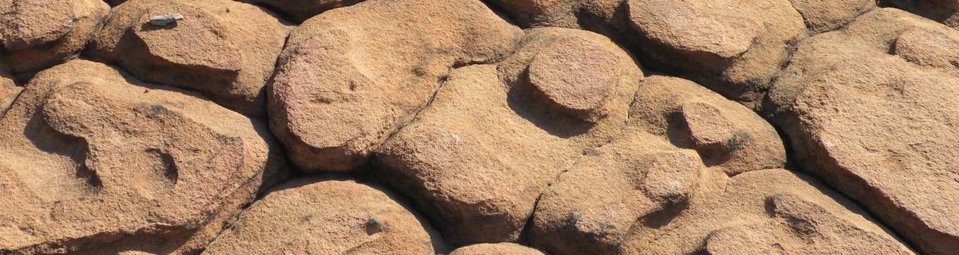
Rocks are generally placed into 1 of 3 major categories: igneous, metamorphic, or sedimentary. Igneous rocks have solidified from molten or partly molten mineral matter. Metamorphic rocks have been altered in the solid state from some pre-existing condition in response to significant changes in temperature, pressure, or chemical environment. Sedimentary rocks are composed of particles of sediment, which are derived by the weathering and/or the erosion of pre-existing rock. Most of the rocks exposed at the surface in Arkansas are sedimentary, but there are some igneous rocks (with adjacent contact metamorphic rocks) and very low grade regional metamorphic rocks in Arkansas also.
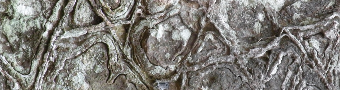
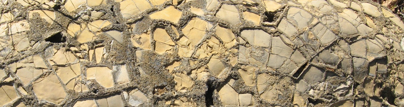
A sedimentary rock consists of two components: the particles and the cement that holds them together. Sedimentary rocks are classified as clastic (rocks made up of grains of sand, silt, and clay) or chemical (rocks made up of shell fragments, saline water deposits, and other materials that are deposited from solution). The most common clastic sedimentary rocks are shales, siltstones, and sandstones. The most common chemical sedimentary rocks are limestone and dolostone.
To understand how sedimentary rocks form, we must account for the processes that create the original particles of sediment, the mechanisms of sediment transport, the processes of deposition or precipitation of a given sediment, and what has happened to the sediment over time. By studying rocks and depositional systems (the processes by which sediments are deposited), geologists recognize that most of the sedimentary rocks in the Paleozoic Highlands of Arkansas are marine. In the southern and eastern parts of the state, the sedimentary deposits are predominantly fluvial (fresh-water processes).
The exposures of igneous rocks in Arkansas are less than 0.1 percent of the entire area of the state. Most are exposed over 15 square miles, principally in Pulaski, Saline, Hot Spring, Garland, and Pike Counties. A few small igneous dikes and sills are present outside the Ouachita region, mostly in the Arkansas Valley, and in at least one case, in the Boston Mountains. Except for some localized contact metamorphism adjacent to the larger igneous intrusions, only very low grade metamorphic rocks are present in the state.
Arkansas is divided into a highland area in the northwest and a lowland region in the south and east. The rocks in the highland area are dominated by well-lithified sandstones, shales, limestones, and dolostones of Paleozoic age. A thin drape of younger unconsolidated clays, sands, and gravel, termed alluvium, is often found in valley floors and associated with the streams and rivers. The sedimentary deposits of the lowlands are mainly unconsolidated clay, sand, and gravel of Quaternary age, poorly consolidated deposits of clay, sand, silt, limestone, and lignite of Tertiary age, and consolidated (to a limited extent) deposits of Cretaceous marl, chalk, limestone, sand, and gravel (see Geologic Map of Arkansas below). Download Arkansas Physiographic Province Map (subdivisions) and Arkansas Physiographic Province Map (county base).
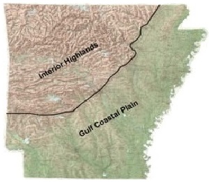
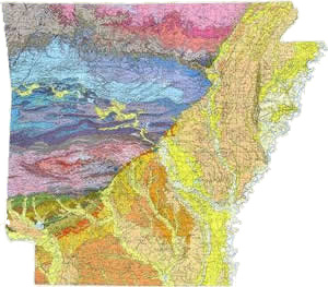
When most of the sediments that compose the rocks in the highland region of Arkansas were being deposited, north Arkansas was a shallow south-sloping sea floor (continental shelf), the Arkansas River Valley was near the edge of the shelf, and the Ouachita area was a deep abyssal plain (see Geologic History). An abyssal plain is the relatively smooth and deep (more than 3,000 feet below sea level) parts of the ocean floor where accumulating sediments have buried the pre-existing topography. In the late PreCambrian Era, a broad uplift domed the Ozark strata with little structural disruption. Starting in the middle to late Paleozoic, a collision of two of the earth's mobile continental plates compressed the sediments of the abyssal plain into the Ouachita Mountains. This multimillion-year-long process folded and faulted the Ouachita strata into a structurally complex mountain chain. The Arkansas River Valley area is the transition zone between the structurally simple Ozarks and the structurally complex Ouachitas with subdued characteristics in each region.
Today, the rocks of the Ozarks tilt slightly to the south and have a dendritic drainage pattern. Since shales and siltstones erode faster than sandstones and limestones, the basic topography is flat-topped mountains with stepped flanks. By contrast, the topographic expression of the Ouachitas is controlled not only by the erosional resistance of the rocks, but also by their internal structure. The strata are complexly folded and frequently faulted. The mountains are mostly east-west-trending ridges supported by erosionally resistant rocks and separated by less resistant rocks. The Arkansas River Valley is characterized by much less intensely folded and faulted strata than the Ouachita region. Erosional processes left the synclines as mountains and the anticlines as valleys.
Geologic History
The past 500 million years of geologic history of Arkansas may be interpreted from the rocks and sediments exposed in the state. A summary of major geologic events, recorded in the rock record, is presented below in a manner (oldest at the bottom, youngest at the top) that allows this information to be readily compared with the correlation charts displayed as part of the Stratigraphic Summary of Arkansas.
Age boundaries in millions of years (Ma)
Cenozoic Era
Quaternary Present to 2.6 Ma
Holocene (Present to .01 Ma):Frequent flooding of the Mississippi and other rivers results in deposition of alluvium. Sand dike injection and extrusion during major earthquakes occurs in northeastern Arkansas. Erosion of the Interior Highlands and down-cutting by most streams occurs.
Pleistocene (.01 to 2.6 Ma): Local alpine snow packs form in the Boston Mountains and Ouachita Mountains. Repeated intervals of erosion and deposition of glacial outwash by the ancestral Mississippi and Ohio Rivers form the Eastern and Western Lowlands and Crowley’s Ridge. Sand and silt winnowed from the outwash form dunes and sheet-like deposits of loess. Erosion occurs over most of the Interior Highlands.
Tertiary 2.6 to 66.5 Ma
Pliocene - Oligocene (2.6 to 33.9 Ma): Erosion over most of the state.
Eocene (33.9 to 55.8 Ma): Marine and fluvial clastic sediments fill the Mississippi Embayment; transportation of some bauxite; swampy conditions favorable to the accumulation of plant debris (lignite). Erosion occurs in the Interior Highlands.
Paleocene (55.8 to 65.5 Ma): Shallow marine sea in the Mississippi Embayment; formation of nearshore reefs and layers rich in marine remains and accumulation of dark marine clays; development of bauxite on islands of exposed Cretaceous igneous rocks. Erosion occurs in the Interior Highlands.
Mesozoic Era
Cretaceous 66.5 to 145.5 Ma
Deposition of water-laid volcanic debris preceded the accumulation of sand, marl, and chalk in shallow marine seas during the Late Cretaceous. About 100 Ma, downwarping of the Mississippi Embayment resulted in the invasion of the region by a shallow sea. Igneous activity in central, southwestern, and eastern Arkansas; nearshore deposition of clastic and carbonate debris in the Early Cretaceous, along with deposition of gypsum and anhydrite in highly saline waters in southwestern Arkansas. Erosion occurs in the Interior Highlands.
Jurassic 145.5 to 201.6 Ma
Deposition of carbonate sand (often oolitic) in a shallow marine environment and some red clay and anhydrite in a shallowing sea; preceded by the accumulation of a thick sequence of salt beds (halite), some anhydrite, and red clay and silt in shallow highly saline waters. Present only in the subsurface in southern Arkansas. Erosion occurs in the Interior Highlands. Jurassic or Triassic: Intrusion of small localized bodies of magma in southern Arkansas, which crystallized to form igneous rocks.
Triassic 201.6 to 251 Ma
Accumulation of predominantly red clay and silt, sand and gravel, and minor beds of anhydrite in a non-marine environment. Present only in southern Arkansas (in the subsurface). Age is indefinite. Erosion occurs in the Interior Highlands.
Paleozoic Era
Permian 251 to 299 Ma
Erosion occurs. Last interval of uplift of the Interior Highlands and end of milky quartz-vein formation.
Pennsylvanian 299 to 318 Ma
Ozark region: Deposition of clastic sediments occurs. Younger Pennsylvanian rocks absent; very late normal faulting.
Arkansas Valley region: Rapid infilling of clastic sediments and development of growth faults along northern basin margin. As the basin shallowed, plant debris (now present as coal) accumulated in nearshore swampy areas.
Ouachita region: Rapid influx of clastic sediments in a deep marine trough followed by intense deformation, such as folding, faulting, and, at depth, low-grade metamorphism; uplift during the Ouachita orogeny. Concurrent formation of quartz veins.
Mississippian 318 to 359 Ma
Ozark region: Deposition and episodic erosion of shallow-water platform carbonate debris, clay, sand, and siliceous ooze.
Ouachita region: Rapid influx of clastic sediments in the Late Mississippian following slow accumulation of siliceous ooze and clay in the Early Mississippian.
Devonian 359 to 416 Ma
Ozark region: Slow deposition of carbonate sediments, siliceous ooze, carbonaceous clay, and some sand in shallow marine water, interrupted by intervals of erosion.
Ouachita region: Slow accumulation of siliceous ooze and clay in a deep marine environment.
Silurian 416 to 444 Ma
Ozark region: Deposition of thin, shallow-water carbonate sediments, interrupted by intervals of erosion.
Ouachita region: Slow influx of sand and clay in a deep marine environment.
Ordovician 444 to 488 MA
Ozark region: Deposition of shallow-water carbonate sediment and minor sand interrupted by intervals of erosion.
Ouachita region: Prolonged deep water accumulation of clay, sand, carbonaceous sediment, and siliceous ooze.
Cambrian 488 to 542 Ma
Ozark region: Calcareous sediment, some quartzose sand, and clay accumulate in shallow water.
Ouachita region: Sediments accumulated as alternating layers of clay, silt, sand, and minor lime mud.
Precambrian Time
Precambrian 542 to 4,600 Ma
Ozark region and northern part of Mississippi Embayment: Granitic-type igneous rocks (some approximately 1,400 Ma) have been encountered in some wells.
Ouachita region: Erratic boulders of late Precambrian igneous and metamorphic rocks and sparse tectonically emplaced bodies of metamorphosed igneous rocks (~ 1,000 Ma) are present in Paleozoic rocks. In these areas, there is no evidence of the succession of events during Precambrian time. Although not exposed elsewhere, Precambrian rocks are assumed to underlie the entire state.
References
Time scale from Palmer (1983). Geology from the AGS.
Walker, J. D., and Geissman, J. W., compilers, 2009, Geologic Time Scale: Geological Society of America, doi: 10.1130/2009. CTS004R2C
Facts About Arkansas
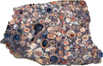
Bauxite - State Rock
This rock was formed by the weathering of nepheline syenite under tropical conditions, a process called laterization. It is a type of lithified soil which is relatively low in silica and high in aluminum. Bauxite was discovered in Arkansas before 1900 and was a major source of ore for aluminum metal for some 90 years in Saline and Pulaski Counties. There are many uses for processed bauxite, aside from metal, including abrasives, cement, refractories, and chemicals. Aluminum compounds are essential ingredients in many common household items, including deodorants, antacids, and paper.
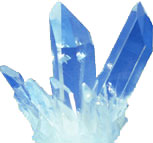
Quartz - State Mineral
Quartz is composed of oxygen and silica combined in a ratio of 2: 1. This mineral is hard, durable, weather-resistant, and relatively common. Quartz crystals formed as hot waters percolated through fractured rock in the Ouachita Mountains some 245 million years ago. Chemically pure sources of quartz are in much demand by industry as a source of the raw chemical feedstock for the manufacture of quartz wafers, silicon metal, glass, fused quartz, and optical fiber. Arkansas has the most significant economically valuable deposits of high-quality quartz in the United States.
Arkansas Quartz Crystals Pamphlet ![]() (526 KB)
(526 KB)
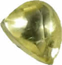
Diamond - State Gem
Diamonds were first discovered in Arkansas in 1906. Since that time over 100,000 diamonds have been recovered from the site now known as Crater of Diamonds State Park. The average size recovered is about .21 carat. Colors of the diamonds range from white to yellow and brown and the natural crystals are usually rounded. The largest diamond found in Arkansas is The Uncle Sam, found in 1924. This diamond weighed 40.24 carats.
Geology And Geography
- Oldest known mapped geologic formation (Collier Shale) about 520,000,000 years old
- Oldest known surface rock (an altered igneous body, Saline County) about 1,025,000,000 years old
- Most abundant sediments – sand, clay, silt, gravel, and marl
- Most abundant sedimentary rocks – shale, sandstone, dolostone, limestone, and chert
- Most abundant igneous rock– syenite (resembles granite, but rarely contains quartz)
- In recent years, an average of 44 earthquakes per year are detected in Arkansas. However, from Jan. 12, 1982 to Jan. 12, 1983, a swarm of nearly 20,000 small earthquakes occurred in Faulkner County.
- Fourteen meteorites have been discovered in Arkansas.
- Area – 53,182 square miles, making Arkansas larger than half of the world’s countries
- Highest point – 2,753 feet above sea level (Magazine Mountain)
- Lowest elevation – 54 feet above sea level (Ouachita River at Arkansas/Louisiana state line)
- Eighteen percent of the state (by area) is irrigated land.
- Navigable length of major rivers: Arkansas River – 308 miles, Ouachita River – 128 miles, Mississippi River – 321 miles, and White River – 255 miles
Minerals And Fossil Fuels
- Arkansas had the 1st diamond mine in the United States and led the nation in the recovery of diamonds for over 50 years. It is the only place where you can find (and keep) a diamond.
- The two largest diamonds discovered in the United States came from Arkansas.
- Arkansas led the nation in the production of barite for over 30 years.
- Arkansas’ annual value of mineral and fossil-fuel production is more than $1,000,000,000.
- Arkansas’ most valuable non-fuel mineral resources, based on annual production (2007 data), are: bromine, crushed stone, cement, and construction sand & gravel, amounting to 92% of hard minerals value.
- Three fossil fuels – natural gas, oil, and coal – are produced in Arkansas today and vast reserves of lignite are essentially untouched.
- In 2012, there were about 207 oil and 150 gas fields in production in Arkansas.
- In 2012, about 6,594,951 barrels of oil were produced in Arkansas.
- As of 2012, about a total of 1,863,343,830 barrels of oil were produced in Arkansas.
- As of 2012, about a total of 10,766,937,122 mcf of gas were produced in northern Arkansas.
- Deepest well ever drilled in Arkansas – 20,661 feet (a test well for gas/oil in Yell County)
- Rocks and minerals currently produced or recovered in Arkansas: Bauxite, Dolostone, Gypsum, Quartz, Tripoli, Cement rock, Gemstones, Limestone, Sandstone, Sulfur, Tuff, Clays, Glass/Industrial Sand, Novaculite, Slate, Syenite
- In 2013, 28% of the global bromine was produced in Arkansas, with Arkansas being the only U.S. producer.
- More bauxite and vanadium ore has been mined in Arkansas than in all other states combined.
Among the states, Arkansas Ranked (as of 2007):
- 1st in the production of bromine
- 1st in the production of quartz crystal and lasca
- 1st in the production of novaculite and silica stone
- 1st in the recovery of diamonds
- 3rd in the production of tripoli
- 4th in the production of kaolin
- 5th in the production of crude gypsum
- 6th in the production of common clays
Most current data for 2007, Arkansas Geological Survey, 2010
Field trips
Geologists look at outcrops anywhere they are accessible and sometimes in places not so accessible. Every now and then we find outcrops so interesting that we cannot keep them to ourselves and as a result we create guidebooks to share with everyone! In our wanderings "in the field" we locate numerous rock spots along roads, trails, or streams. To see outcrops along roads view the Roadside Geology section below or to see outcrops along streams view the Geofloats section below.
Roadside Geology
Petit Jean Highway 154 ![]() (413 KB)
(413 KB)
Petit Jean & Mt Magazine Tour ![]() (1.27 MB)
(1.27 MB)
Mt Magazine Highway 309 ![]() (413 KB)
(413 KB)
Scenic 7 Byway ![]() (68 MB)
(68 MB)
Geologic Road Guide to Arkansas State Highway 10 ![]() (10.1 MB)
(10.1 MB)
Trail Guides
Mt Nebo Geology Fieldtrip ![]() (1.74 MB)
(1.74 MB)
Geofloats
Buffalo National River Geofloat Guide ![]() (909 KB)
(909 KB)
Ponca Geology Map ![]() (468 KB)
(468 KB)
Ponca Topographic Diagram ![]() (465 KB)
(465 KB)
Lake Ouachita Geofloat Guide ![]() (5.9 KB)
(5.9 KB)
Explore Field Trips Map
Mineral Collecting Localities
- Banded Chert occurs 0.2 of a mile north of the Busch Post Office on the east side of U.S. Highway 62. This chert shows concentric banding of light and dark layers and polishes readily.
- Agate Located at the intersection of Greene County Roads 407 and 466 is the Tri-County Sand and Gravel operation. Contact operator Dale Gulledge (870-323-2142) to arrange collecting times.
- Phosphate Rock occurs in a county road ditch 0.6 of a mile east of East Lafferty Creek. The phosphatic nodules are black when fresh and have a white coating upon weathering.
- Manganese Ore Manganese ore is found 1.2 miles east of the county road and Arkansas Highway 69 in Cushman. Manganese minerals found in this area are psilomelane, braunite, pyrolusite, and hausmannite.
- Wavellite Northwest on U.S. Highway 270 approximately 3.5 miles from Mount Ida, turn right (east). Wavellite occurs at the county quarry, located approximately 0.7 of a mile east and on the north side of the road.
- Antimony To reach an abandoned antimony mine, turn north off of U.S. Highway 70, 0.5 of a mile west of the Sevier-Howard County line. Proceed about 2.2 miles north past the turnoff to the Jefferson Ridge use area. Turn west (left) onto Weyerhaeuser Road No. 50,000. Proceed 3.6 miles (the second dirt crossroad) and turn right (north). Approximately 0.3 miles north is a faint crossroad. At this crossroads, the dump pile from the mine is on the northwest corner.
- Celestine Celestine is exposed in a Howard County road ditch about 3 miles south of Dierks.
- Barite Collect barite cemented gravel east of Dierks, AR near the intersection of 24500 Rd and 24100 Rd.
- Cinnabar Cinnabar occurs at the end of the cove between the Pikeville public use area and the Parker Creek use area on Lake Greeson; and 2.2 miles west of Arkansas Highway 27 in the road ditch.
- Diamonds The only lamproite pipe in North America which has been mined for diamonds is 2.5 miles southeast of Murfreesboro. A daily fee is charged to hunt for diamonds in Crater of Diamonds State Park.
- Quartz Crystals Coleman’s quartz crystal mines are located near Coleman’s Rock and Mineral Shop in Blue Springs on Arkansas Highway 7. This is a fee paid commercial attraction with collecting done on a finders-keepers basis. See also the Mt. Ida Chamber of Commerce (870-867-2723), Crystal Directory
- Wavellite and Variscite On a county road approximately 1.8 miles north of Avant, wavellite and variscite occur in the road ditch and on the hill to the east. Locally known as "cat’s eye", radiating rosettes of green wavellite and green crusts of variscite are sought after by many collectors.
- Magnet Cove
(A) Sphene nepheline syenite occurs at the curve on the north roadbank on Arkansas Highway 51 about 0.5 miles west of Cove Creek.
(B) Carbonatite occurs in the north roadbank just west of the Cove Creek bridge on Arkansas Highway 51. Locally, the carbonatite contains carbonate-apatite, monticellite, magnetite, perovskite, kimzeyite, and biotite.
(C) A boulder containing eudialyte nepheline syenite pegmatite is near the southwest corner of the Cove Creek bridge abutment just south of location B.
(D) Weathered biotite, melanite garnet and residual masses of nepheline occur in the south bank of Arkansas Highway 51, near the Magnet Cove Church.
(E) Pyrite occurs in Cove Creek approximately 0.2 of a mile east of the iron bridge (Road north from Highway 51, east of Magnet Cove Cemetary). - Syenite
(A) A variety of syenite termed Pulaskite occurs 0.3 of a mile south of Fourche Creek on Arkansas Highway 367
(B) Nepheline syenite occurs along the road ditch at the Dixon Exit on U.S. Highway 65 and 167. Also, nepheline syenite and pulaskite are exposed in road cuts north on U.S. Highway 65 from this junction.