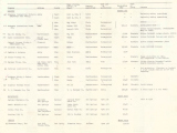
Historical Maps and Data
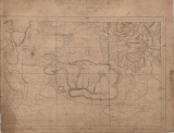
Historical Maps
Historic paper maps that have been scanned to PDF format and date back to as early as 1888. Generally include but are not limited to: cross sections, topography, geology, field and area maps.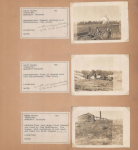
Historical Photos
Historic photographs that were taken of a variety of subjects, particularly interesting geological features of Arkansas. Each page has been scanned to PDF format. Photos range in origin from between the early 1920s to the mid 1940s.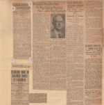
Historical Written Media
This section consists of historic news clippings ranging in origin from between 1925 to 1945. Each page has been scanned to PDF format. Each topic is based on a geologic topic that is relative to Arkansas based on the availability of certain materials.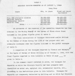
Historical Critical Minerals
Figures showing know locations of critical mineral occurrences in the state. Figures highlight antimony, barite, bauxite, lithium, manganese, strontium, titanium and igneous complexes. Draft map, "Depth of Crystalline Basement". This figure shows locations where crystalline basement rock were encountered.