Devonian
Penters Chert/Formation
Age: Early (to Middle?) Devonian Period
Distribution: Central northern Arkansas
Geology: The Penters Chert is a fine-grained, fossiliferous, dolomitic, limestone with some chert and siliceous replacement overlain by a massive, dense, mottled gray chert with some patches of fine-grained limestone. A thick bed of chert breccia occurs at the top of the Penters Formation in some sections. The formation is unfossiliferous at its type locality, but a restricted brachiopod fauna has been recovered from the base of the formation in another area. The Penters Chert is of sporadic exposure in its outcrop area. The lower contact is disconformable. The thickest outcrop exposure is about 25 feet; however, at least one report suggests a maximum thickness of about 90 feet.
Original reference: H. D. Miser, 1920, U. S. Geol. Survey Bull. 715-G.
Type locality: Named for exposures at Penters Bluff Station, Izard County, Arkansas
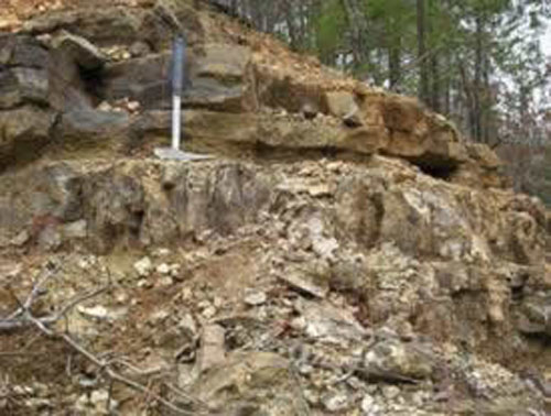
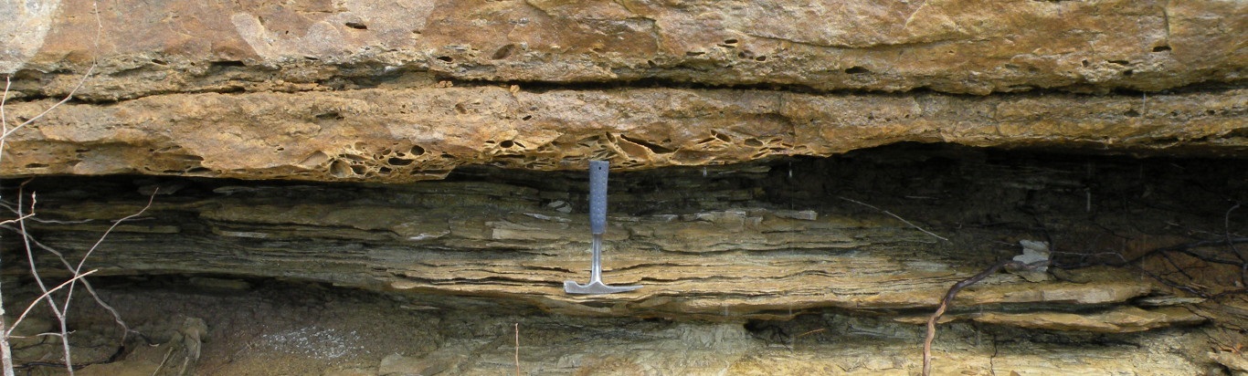
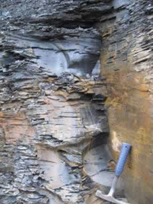
Rock hammer is resting on the top of the Penters Chert. Basal Mississippian sandstone and shale are present above the chert as shown here near Cushman, Arkansas
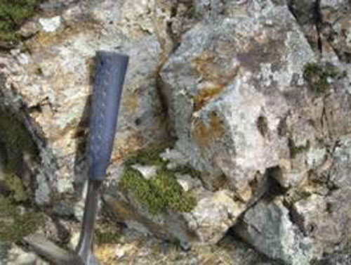
Blocky Penter Chert from Painter Bluff along the White River
Clifty (Limestone)/Formation
Age: Middle Devonian Period
Distribution: Northwestern Arkansas
Geology: At its type locality the Clifty Limestone is a thin, very sandy limestone with few fossils. Outside the type area the Clifty Formation mostly consists of sandstones. This unit is often confused with or inadvertently combined with the Sylamore Sandstone Member of the Chattanooga Shale. Brachiopods have been collected from the Clifty Formation. The unit is disconformable with the underlying beds. The maximum thickness of the formation is only 4 feet, but it is usually thinner, averaging 2 feet or less.
Original reference: A. H. Purdue and H. D. Miser, 1916, U. S. Geol. Survey Geol. Atlas, Folio 202.
Type locality: Named for East Fork of Little Clifty Creek, Eureka Springs quadrangle, Carroll County, Arkansas
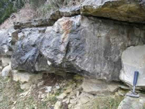
Clifty Sandstone above rock hammer – approx 2.5 feet at BeaverDam. Thin sandstone above Clifty Formation is the Sylamore Sandstone Member of the Chattanooga Shale
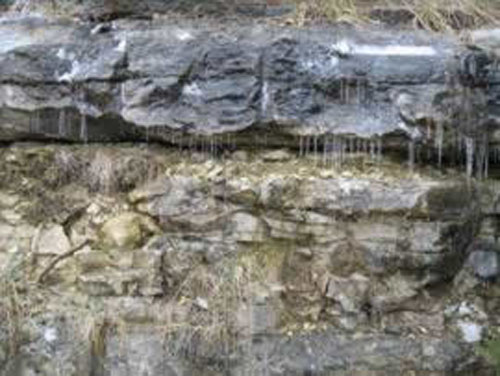
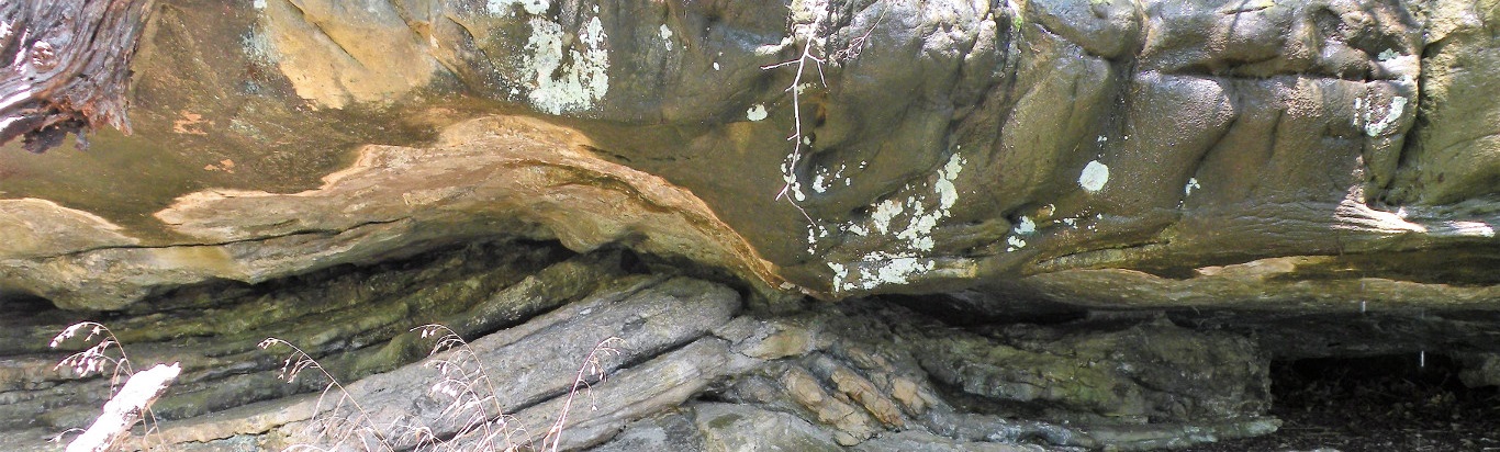
Clifty Sandstone (above icicles) above the Powell Formation at Beaver Dam
Chattanooga Shale/Formation
Age: Late Devonian Period (and Early Mississippian Period?)
Distribution: Northern Arkansas, Ozark Plateaus; Tennessee, Alabama, Kentucky, Mississippi, and Oklahoma
Geology: Typically a black, fissile clay shale that weathers into thin flakes. The beds are usually cut by prominent joints creating polygonal blocks upon weathering. The upper part of the formation may be slightly sandy and usually contains abundant pyrite. The Chattanooga Shale is all Devonian in Arkansas. A lower sandstone Member (Sylamore Sandstone) may dominate or fill the Chattanooga Shale interval in some areas. The Sylamore is a white to dark-gray phosphatic quartz sandstone. Its texture is fine-grained to sandy conglomerate. The formation contains few fossils, but conodonts and some brachiopods have been recovered. The basal contact is unconformable. The thickness of the Chattanooga Shale(including the Sylamore Sandstone) ranges from 0 to about 85 feet, but normally averages about 30 feet.
Original reference: C. W. Haynes, 1891, Geol. Soc. America Bull., v. 2, p. 143.
Type locality: Hillside exposure at north end of Cameron Hill, Chattanooga, Hamilton County, Tennessee. Standard section: Cut on Tennessee Highway 26, at east approach to Silgo Bridge over Caney Fork, 7.1 miles east of courthouse at Smithville, DeKalb County, Tennessee
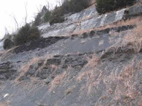
Chattanooga Shale at Bella Vista Arkansas. Approximately 30-40 ft. exposed. The St. Joe Limestone Member of the Boone Formation is present above the Chattanooga Shale.