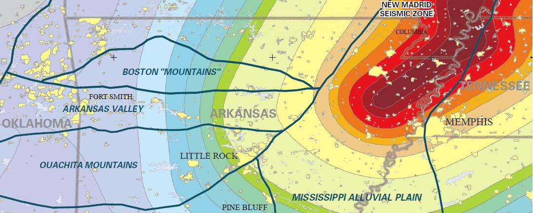
New Madrid Seismic Zone of Northeast Arkansas
| AGC/AGS Series | Digital Geohazard Maps |
| Number Series | GH-EQ-NMSZ-005 |
| Title | New Madrid Seismic Zone of Northeast Arkansas |
| Author (s) | S.M. Ausbrooks and Erica Doerr |
| Date | 2008 |
| Scale | |
| General Description |
This map depicts the locations and magnitudes of selected seismic events in New Madrid seismic zone of Northeast Arkansas. On December 16, 1811 residents living in the region near New Madrid, Missouri were jolted awake at 2:15 AM by a major earthquake. Cabins collapsed, people were frightened, and the land surface was severely changed by liquefaction. The shaking was felt over approximately 2 million mi2 (3,219,000km2 ) and as far away as New England and Canada. Scientists estimate that this event measured over a M7.0 (Johnston and Schweig, 1996). This marked the first of a series of powerful earthquakes that spanned a three-month period. Hundreds of aftershocks were reported for over a year. Since that time, at least 20 damaging earthquakes have occurred in the NMSZ (Nuttli, 1982). An estimated M6.0 earthquake was reported near the town of Marked Tree, Arkansas on January 4, 1843. This earthquake caused the land to subside forming new lakes and did damage to chimneys and brick structures (Jackson, 1979). A M5.0 earthquake was recorded on March 24, 1976 in Poinsett County. This earthquake was felt over an area of 174, 000 mi2 (280,000km2 ) bounded by Centralia, Illinois; Hopkinsville, Kentucky; Nashville and Clifton, Tennessee; Birmingham, Alabama; Little Rock, Arkansas; and Jefferson City, Missouri. In Arkansas, multiple cities reported an Intensity VI. Power outages, downed telephone lines in Jonesboro, broken windows in Paragould, cracked plaster in Marked Tree, roof damage and fallen ceiling tile as far away as Decatur, Arkansas (Jackson, 1979). The most recent events to rattle the residents of northeast Arkansas were felt near the towns of Caraway and Manila, Arkansas in Poinsett County in 2005. Both of these earthquakes registered a M4.1 with an Intensity V. Although significant damage has not been reported in recent years, the NMSZ is still considered active and is potentially capable of generating powerful earthquakes.
|
| Availability | Yes. Paper copy or free download. |
| Price | Paper copy is $12.50 or download map for free. |
| Shipping and handling | Contact Sales Office at (501) 296-1877, for shipping and handling charges. |
| Online Version |
Download PDF |