Digital Geologic Map of Little River County, Arkansas
| AGC/AGS Series | Digital Geologic Maps |
| Number Series | DGM-AR-081 |
| Title | Digital Geologic Map of Little River County, Arkansas |
| Author (s) | Geologic mapping by W.D. Hanson, B.F. Clardy, B.R. Haley and C.G. Stone Edited and compiled by W.D. Hanson |
| Date | 2006 |
| Scale | 1:100,000 |
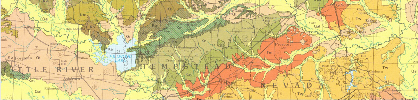
| General Description |
The Geologic Map of Little River is a compilation of geologic maps of the Mineral Springs South, Red Bluff, McNab, Fulton, Homan, Ben Lomond, Cerrogordo, Falls Chapel, Horatio, Lockesburg, Arkinda, Foreman, Arden, Ashdown West, Ashdown East, Daniels Chapel, Redbank, Barkman, Ogden, Silver Ridge and Winthrop Quadrangles. The present ESRI software environment has allowed the geology of the entire county to be presented as a single layer. Encompassed in this layer are structural data, economic mineral data, and surface geology data. The map unit description gives the color, symbol, and general lithology of each individual unit represented. The correlation chart displays the order in which each unit was deposited and if any breaks in sediment deposition occurred. All digital work was done by the staff of the Arkansas Geological Commission using ArcMap 9.1. This product is available through the Arkansas Geological Survey.
The report that accompanies the geologic map of Little River County, Arkansas includes:
*Includes: 9 pages, 7 figures, 3 plates |
| Availability | Yes. Paper copy or free download. |
| Price | Paper copy is $45.00 or download map for free. |
| Shipping and handling | Contact Sales Office at (501) 296-1877, for shipping and handling charges. |
| Online Version |
Download PDF Download report PDF |