See list below for 1:62,500 scale Digital Geologic Maps
| AGC/AGS Series | Digital Geologic Maps |
| Number Series | DGM-1:62,500 SERIES |
| Title | See list below for 1:62,500 scale Digital Geologic Maps |
| Author (s) | AGS Staff |
| Date | Vary |
| Scale | 1:62,500 Scale - 15 Minute |
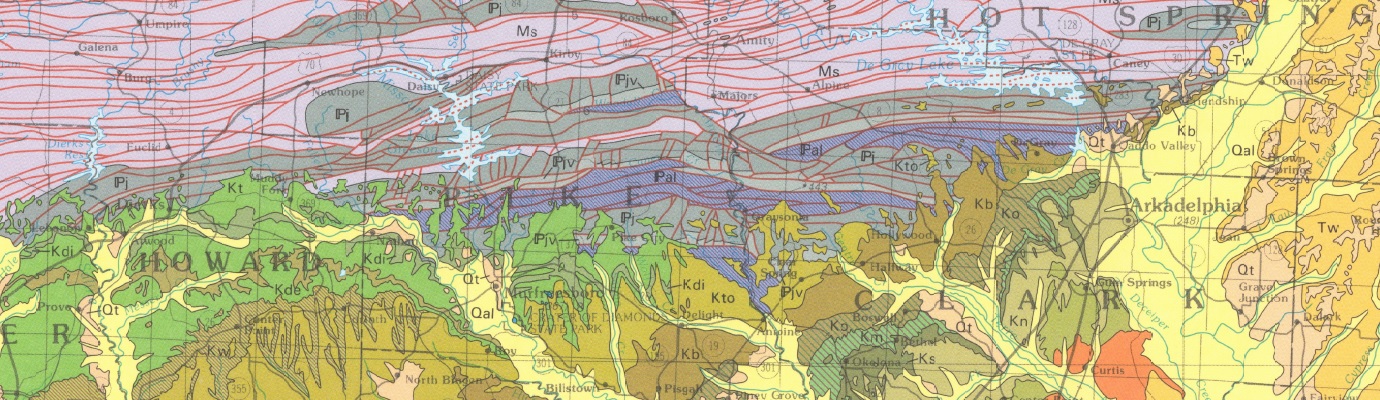
| General Description |
Digital Geologic Quadrangle Maps - paper copies are print-on-demand products and size will vary from map to map. The Digital Geologic Quadrangle Maps (DGM) series is a collection of geologic maps produced at a 1:62,500 scale. Most of these maps were produced in cooperation with the USGS through Cooperative Geologic Mapping Programs. Each map contains geologic formation contacts, fault, structure, and attitude of bedding (strike and dip) data at a 1:62,500 scale. Also included on most of the maps are a cross-section, correlation and description of map units, references, and a stratigraphic column for the quadrangle. The primary purpose of these geologic maps is to show the geologic formations present at the surface at a 1:62,500 scale. The contacts were drawn on a 15 minute quadrangle base and then digitized by a cartographer in ArcGIS. Interpretations were made where outcrops were covered by unconsolidated sediment or vegetation. Photographic or digital enlargement of these maps to scales greater than that at which they were originally mapped can cause misinterpretation of the data. |
| Availability | Yes. Paper copy, CD-Rom or free download. |
| Price | Paper copy is $12.00, CD-Rom is $25.00 or download map for free. |
| Shipping and handling | Contact Sales Office at (501) 296-1877, for shipping and handling charges. |
| Online Version |
Blytheville Hales Point Osceola |